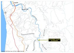
About the Maps
The latter map of aboriginal Yurok territory is part of a set of GIS (Geographic Information System) layers that you may download to construct your own maps. If you are new to GIS, go to Learn2Map.com for a free tutorial.
Marlon Sherman, Professor of Native American Studies at Humboldt State University, prepared the following discussion about maps and boundaries of aboriginal territory.
Boundary lines on maps are artificial constructs. Sharply delineated lines, drawn arbitrarily, generally have little meaning in aboriginal or indigenous terms. As a cultural or geographic matter, many, if not most indigenous societies were formed and maintained within watershed boundaries. As a political matter, many modern indigenous societies view boundaries as tools of oppressive colonial governments that facilitate repressive or genocidal policies. Indigenous Peoples throughout the earth generally coalesced as societies long before the formation of modern nation-states, and struggle with cross-boundary issues that result from differing immigration policies of the various nations.
The lines on the above maps are used strictly for informational purposes, and cannot and should not be used to prove right to ownership of the parcels of land so delineated.
For example, the boundaries noted on the map of aboriginal Yurok territory are all either arbitrarily drawn by anthropologists/ethnologists, or are the results of government-approved surveys that have subsequently been entered into official county land records.
The anthropological lines only roughly approximate areas that Yurok-speaking peoples once either inhabited or visited and used on a regular basis. They are the result of first-person interviews with Yurok individuals in the early Twentieth Century as well as often unreliable information gleaned from non-Indian interlopers or surrounding tribal groups.
The history of government-recorded property lines delineating both private and government property in the West are generally the result of fraud and coercion, not only on the part of the miners, loggers and other settlers, but due to the third-party surveying contractors, some of whom never even walked the land they mapped. Although these property lines have become pretty much settled as of the 21st Century, they are still the source of much bitterness among Native Peoples, who lost the homes and use rights they had enjoyed for untold centuries.
Finally, although the United States government has since 1989 recognized a separate Yurok Reservation, with boundary lines extending from approximately the mouth of the Klamath River to its confluence with the Trinity River, and one mile on either side of the Klamath River, some Yurok people still practice traditional Yurok land use beliefs and practices in regard to land ownership and property boundaries, rather than acknowledge either Yurok or United States law.
This map, then, shows the approximate areas Yurok peoples lived in or utilized on a regular basis before the coming of Europeans or Americans, and shows areas Yuroks are forbidden from living or utilizing today, due to federal and state laws, as well as corporate and private control of lands.